Active Seismic

Geophysical methods provide continuous subsurface insight to support mining operations and infrastructure with minimal disruption to site conditions. They deliver high-density spatial data that improves confidence in ground conditions, reduces risk, and supports safer, more efficient design, construction, and ongoing asset management across the mine lifecycle.
Contact UsProudly Servicing Industry Leaders
Mining Geophysics for Infrastructure, Stability and Asset Management
GBG Group Australia provides specialist mining geophysics services to support mining programs across complex resource projects, delivering non-invasive subsurface insight to inform design, reduce uncertainty, and improve outcomes across mine development, operations, and closure. Our mining geophysical survey approach provides continuous data between boreholes and traditional testing, improving confidence in ground models and enabling early identification of subsurface variability, geohazards, asset performance and conditions that may impact constructability and long-term asset integrity.
Geophysical methods are applied across a wide range of mining infrastructure investigation requirements, including tailings storage facilities, fixed plant foundations, haul roads, rail, pipelines, and associated infrastructure, as well as supporting resource and overburden characterisation for recovery. By integrating geophysics into mining investigations, GBG enhances spatial coverage, reduces reliance on intrusive testing alone, and improves confidence in decision-making across the mine lifecycle.
For tailings storage facilities, GBG delivers these capabilities through Tailings First, a structured, lifecycle-focused framework for TSF management. Combining geophysical surveys, geotechnical data and real-time subsurface monitoring, it enables proactive identification of subsurface risks and supports the long-term performance, compliance and safety of tailings assets from feasibility through to closure. Learn more about Tailings First.
Contact Us
Methods
We utilise the following geophysical methods:


Passive Seismic
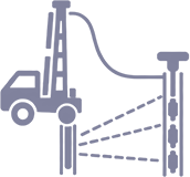
Downhole and Crosshole Seismic

Electrical Resistivity Tomography (ERT)

Vertical Electrical Sounding (VES)

Frequency Domain Electromagnetics (FDEM)

Time Domain Electromagnetics (TDEM)

Ground Penetrating Radar (GPR)

Magnetic Gradiometry

Microgravity

Downhole Wireline Logging
Applications

Tailings Storage Facility (TSF) Design, Assessment, Monitoring and Seepage Evaluation
Characterisation of subsurface conditions within and beneath tailings storage facilities to support assessment and risk management across the full TSF lifecycle, from design and construction through to monitoring and closure.

Waste Rock Dumps, Embankments and Earth Structure Stability Assessment
Assessment of subsurface conditions within waste rock dumps, embankments, berms, and other built earth structures to support stability evaluation and risk management.

Seepage and Containment Leakage Assessment
Identification of seepage conditions and leakage pathways associated with containment structures including tailings facilities, waste dumps, and process water storages, and their interaction with natural watercourses and groundwater systems.

Mine Infrastructure, Foundations and Excavation Assessment
Characterisation of subsurface conditions to support the design and construction of mine infrastructure including fixed plant, haul roads, rail, and conveyor systems.

Subsurface Voids and Abandoned Workings Detection
Identification of subsurface voids associated with natural features or historic mine workings beneath pit floors and operational areas to support safe development and ongoing operations.

Pit Floor, Overburden and Resource Characterisation
Characterisation of near-surface conditions across pit floors and overburden profiles to support exploration, resource evaluation, and mine planning.
FAQs
Geophysical surveys are well suited to mining projects where understanding subsurface variability is critical, including tailings storage facilities, waste dumps, mine infrastructure, pit development, and resource characterisation. They provide continuous spatial information to support design, operations, and risk management across the mine lifecycle.
Geophysics can support tailings dam assessment and ongoing monitoring by identifying subsurface variability, internal structure, and seepage conditions that influence stability. These methods complement traditional investigations and provide broader spatial context to inform risk management and asset performance over time.
The most appropriate method depends on site conditions, target depth, and project objectives. In many cases, a combination of techniques is used to provide complementary information, with survey design tailored to support specific mining and geotechnical outcomes.
Geophysical surveys do not replace drilling but provide continuous subsurface information between investigation points. They can be used prior to intrusive testing to develop an overall site model and guide targeted drilling, improving confidence and reducing uncertainty across mining investigations.
Typical requirements include site plans, investigation objectives, known ground conditions, and any existing geotechnical or geological data. Information on access, infrastructure, and operational constraints is also important to plan safe and efficient survey delivery.
Survey duration depends on site size, access conditions, and scope. Smaller investigations can often be completed within a few days, while larger or more complex mining surveys may take longer depending on logistics, terrain, and operational constraints.
Deliverables typically include processed geophysical data, interpreted sections or models, and engineering-focused commentary on subsurface conditions. Outputs are tailored to mining applications and may include ground models, depth to rock mapping, and identification of subsurface hazards to support design and operations.
Yes, geophysical surveys can be carried out within active mining environments, including around operating infrastructure and within pits, subject to appropriate safety and operational controls. Suitability depends on factors such as ground conditions, access, seismic and electromagnetic noise, and interference, and surveys are typically designed to minimise disruption while maintaining data quality.
Why GBG Group for Mining Geophysics
GBG Group delivers mining geophysics solutions tailored to geotechnical investigation mining programs, providing continuous subsurface data between boreholes and test locations across complex resource projects. Our approach enhances traditional investigations by improving ground models, identifying subsurface variability, and supporting key design inputs for mining infrastructure and tailings storage facilities, reducing uncertainty and improving project outcomes.
Mining Investigations for Infrastructure and Development
Our mining geophysics services provide critical insight into subsurface conditions for mine development, expansion, and infrastructure design. By combining intrusive testing with non-invasive geophysical survey techniques, we deliver continuous ground models that improve spatial coverage, reduce uncertainty, and support safer and more efficient project delivery.
Integrating Geophysics with Geotechnical and Geological Data
Geophysical data is integrated with boreholes, test pits, and geological information to bridge gaps between discrete investigation points. This approach improves confidence in subsurface interpretation and supports more effective design and operational decisions.
Subsurface Conditions and Ground Characterisation in Mining
We characterise subsurface conditions across mining environments through detailed profiling of rock mass, overburden, and structural variability, providing insight into ground behaviour and supporting infrastructure design, excavation planning, and risk management.
Rock Mass, Weathering and Structural Controls
Subsurface profiling defines rock mass characteristics, weathering profiles, and structural features such as faults and fracture zones. This information supports excavation planning, foundation design, and identification of potential geohazards
Groundwater and Seepage Pathways
Investigations identify groundwater conditions and seepage pathways that may influence ground behaviour and asset performance. This supports environmental management, dewatering strategies, and tailings storage facility assessment.
Tailings Storage Facility Investigations
Geophysical surveys support the full lifecycle of tailings storage facilities, from feasibility and design through to operation, monitoring, and closure. These investigations provide insight into subsurface conditions, internal structure, and seepage behaviour, supporting risk management and long-term asset performance.
Feasibility, Design and Site Selection
During early-stage investigations, geophysical methods are used to assess ground conditions, identify zones of weakness and variability, and support optimal TSF siting and design, reducing uncertainty during project development.
Monitoring and Lifecycle Management
For existing assets, geophysical surveys provide repeatable monitoring of subsurface conditions, including material behaviour and seepage. This supports proactive risk management, operational decision-making, and closure planning.
Survey Workflow and Data Interpretation
Our workflow ensures efficient acquisition, processing, and interpretation of geophysical data, delivering clear, engineering-focused outputs that integrate with mining, geological, and geotechnical datasets. These results support informed decision-making across design, operations, and asset management.
Latest Projects
View All

4,000+ Projects Across Australia and Asia-Pacific
Our experienced geophysical survey specialists work closely with engineers and project teams to design investigation strategies tailored to site conditions, risk profiles and engineering objectives. Speak directly with a geophysicist to discuss your project.
Contact Us
Please complete the form below and a member of our team will be in touch as soon as possible.
Our Partners
Partnering with industry leaders to strengthen technical capability and project delivery.