Natural Gamma Logging
Measures natural gamma radiation to identify lithological variation and support stratigraphic interpretation.

Downhole logging involves deploying specialised probes within boreholes to measure subsurface properties, providing direct insight into geology, structure and groundwater conditions.
Contact UsDownhole logging is a subset of borehole geophysics focused on characterising conditions within the borehole itself. While borehole geophysics can be used to investigate subsurface conditions both between boreholes and at depth, downhole logging provides detailed, continuous measurements along the borehole.
These methods are typically deployed using wireline systems and include tools such as acoustic and optical televiewers, as well as sensors for measuring natural gamma, resistivity and fluid properties. This allows identification of lithological changes, fractures, groundwater-bearing zones and material variability with depth.
Borehole logging and imaging are particularly useful for interpreting structural features such as dipping bedding, joints and faults, especially in situations where core orientation is unreliable or difficult to maintain. They are also well suited to angled boreholes where traditional core logging is limited, and for detailed post-drilling characterisation to support interpretation and reporting. The continuous in-hole data they provide further supports the development of digital ground models.

Measures natural gamma radiation to identify lithological variation and support stratigraphic interpretation.
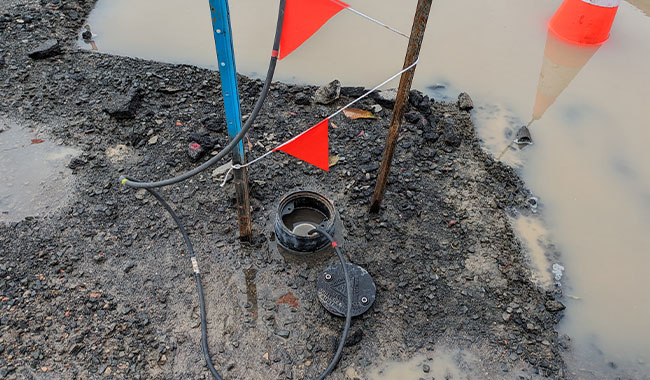
Records electrical resistivity variations within the borehole to identify changes in material properties and groundwater conditions.

Measures borehole diameter to identify washouts, cavities and zones of instability, providing context for other downhole logging datasets.

Provides high-resolution borehole imaging of the borehole wall, enabling detailed fracture mapping and structural interpretation.
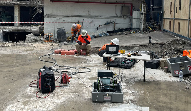
Captures optical images of the borehole wall under suitable conditions, supporting visual interpretation of lithology, fractures and bedding as part of borehole logging services.

Measures seismic wave velocities within the borehole to provide insight into material stiffness and dynamic properties as part of a downhole geophysical survey.
Downhole logging is a form of borehole geophysics used to measure subsurface properties within a drilled hole. As part of modern downhole geophysical surveys and borehole logging services, it is commonly used in geotechnical, environmental and groundwater investigations to provide continuous data alongside physical core samples and improve subsurface interpretation.
Borehole geophysics encompasses a range of geophysical methods used to investigate subsurface conditions within and between boreholes. Downhole logging is a subset of borehole geophysics, providing detailed information within the borehole, while other techniques such as crosshole seismic and vertical seismic profiling (VSP) investigate conditions between boreholes or at depth. Together, these methods support geotechnical, hydrogeological, environmental and mining investigations.
A range of geophysical logging methods are available including gamma logging, resistivity logging borehole, caliper logging, and advanced borehole imaging using acoustic televiewer and optical televiewer systems. The selection depends on project objectives, ground conditions and borehole construction.
Yes. Downhole logging and borehole geophysics can identify fractures, structural features and groundwater conditions. Acoustic televiewer and borehole imaging tools map fracture orientation and continuity, while groundwater logging and resistivity data help identify water-bearing zones and flow pathways.
Borehole geophysics and geophysical logging provide continuous, objective measurements that complement core logging. While core provides physical samples at discrete intervals or in a continuous manner. Often there are breaks in core due to drilling methods, bedding planes or fracturing. Downhole geophysical surveys are in-situ, compass and gyroscopically oriented which allows for improved confidence of the in-situ conditions.
To plan effective borehole logging services, we typically require borehole depth, diameter, casing details, drilling method and access conditions. This ensures the selected downhole logging tools and geotechnical borehole logging approach are suitable for the investigation.
Most downhole logging and geophysical logging programs can be completed within a few hours once the borehole is ready, depending on depth, borehole conditions and the number of logging tools deployed. Larger downhole geophysical surveys may require additional time.
Deliverables from borehole logging services typically include processed logs, interpreted profiles, borehole imaging outputs, and integrated datasets. These results support geotechnical design, groundwater assessment and environmental investigations by providing clear, actionable information.
With over 30 years of experience in Australia, GBG Group combines technical expertise with practical site knowledge to deliver reliable borehole geophysics outcomes. We focus on providing high-quality data, clear interpretation and responsive project delivery to support confident decision-making.
A range of borehole geophysics tools are deployed depending on project objectives, ground conditions and borehole construction.
Televiewer systems provide detailed borehole imaging, enabling structural interpretation including fracture orientation, bedding planes and discontinuities.
Logging data is integrated with core samples and drilling records to validate interpretations, refine stratigraphy and improve overall data quality using geotechnical borehole logging approaches.
Downhole logging services are widely used across geotechnical, environmental and hydrogeological investigations, providing critical data for design, risk assessment and resource evaluation.

Our experienced geophysical survey specialists work closely with engineers and project teams to design investigation strategies tailored to site conditions, risk profiles and engineering objectives. Speak directly with a geophysicist to discuss your project.
Please complete the form below and a member of our team will be in touch as soon as possible.
Partnering with industry leaders to strengthen technical capability and project delivery.