
Overview
Location
Queensland
Year
2026
Methods
Land and marine Seismic Refraction Tomography (SRT)
Land and marine Electrical Resistivity Tomography (ERT)
Single Beam Echo Sounder (SBES) bathymetry
Background
GBG was engaged to carry out a geophysical investigation along a proposed horizontal directional drilling (HDD) alignment, part of which passes beneath a river.
Ground conditions matter for HDD design. The depth to rock, and how much it varies along the alignment, affects the drill profile, the choice of tooling and the risks during drilling. Boreholes give reliable information at individual points but leave gaps between them. This is especially true beneath a river, where drilling is harder and more expensive. Geophysics was used to fill those gaps with a continuous profile from bank to bank.
Objective
The investigation aimed to provide subsurface information to:
- Determine the depth to bedrock and how rock competence varies along the alignment
- Identify lateral and vertical variability in subsurface conditions
- Correlate the geophysical results with existing borehole data
Methods
The investigation combined three techniques across land and water. This let the team build one continuous picture of the subsurface along the full alignment.
Single beam echo sounding (SBES)
A single beam echo sounder sent acoustic pulses vertically down to the riverbed and measured how long each echo took to return. Using the speed of sound in water, the system converted these travel times into water depths. Combined with RTK GNSS positioning, this produced an accurate riverbed elevation profile. That profile set the true elevations of the submerged geophones and electrodes, which is needed to model the seismic and resistivity data correctly.
Seismic refraction tomography (SRT)
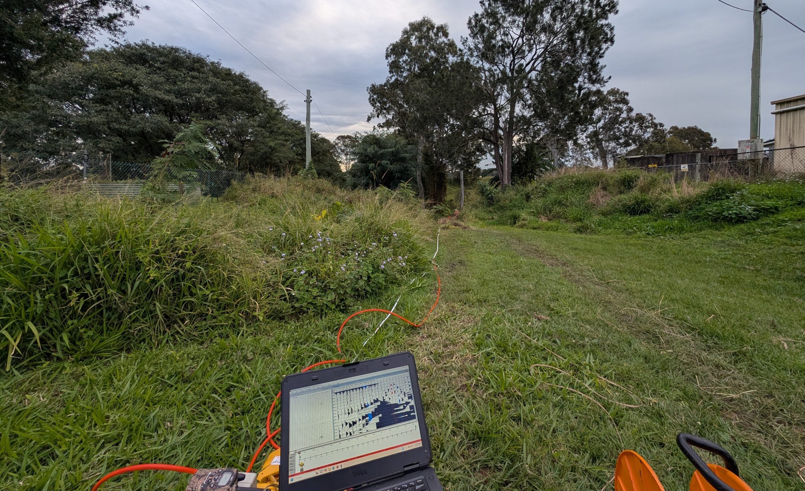
Seismic data was first acquired on a 48-channel spread running from land and across the river. A 24-channel land spread followed, with several geophones overlapping the first spread so the two datasets could be tied together (Figure 2).
On land, sledgehammer impacts were stacked to generate the seismic energy. Over the water, a 20 cubic inch airgun mounted on the survey vessel was used, charged with compressed nitrogen from onboard cylinders. The seismic cable was deployed from the boat with weights attached so it settled on the riverbed and coupled well with it.
Electrical resistivity tomography (ERT)
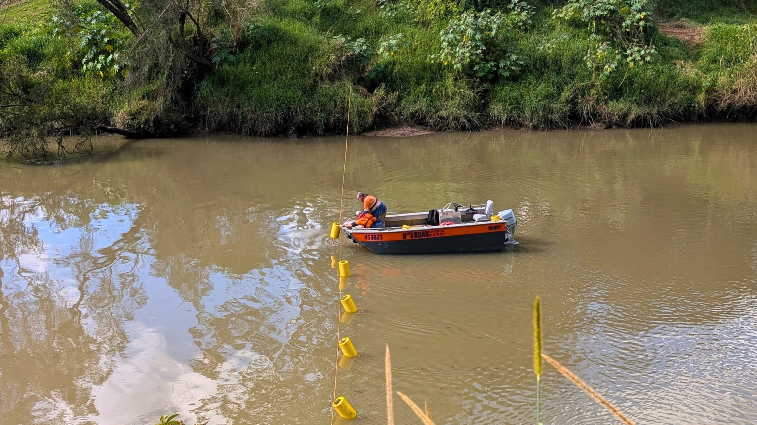
On land, ERT was carried out using steel electrodes driven into the ground. Across the river, electrodes fitted with flotation devices hung from a cable tensioned from bank to bank, and weighted chains dropped from the line to the riverbed (Figure 1).
Outcome
The investigation gave a continuous view of ground conditions between boreholes, including beneath the river channel. This reduced uncertainty in the areas the drilling couldn’t reach and gave the design team more confidence in their subsurface assumptions for the HDD alignment.
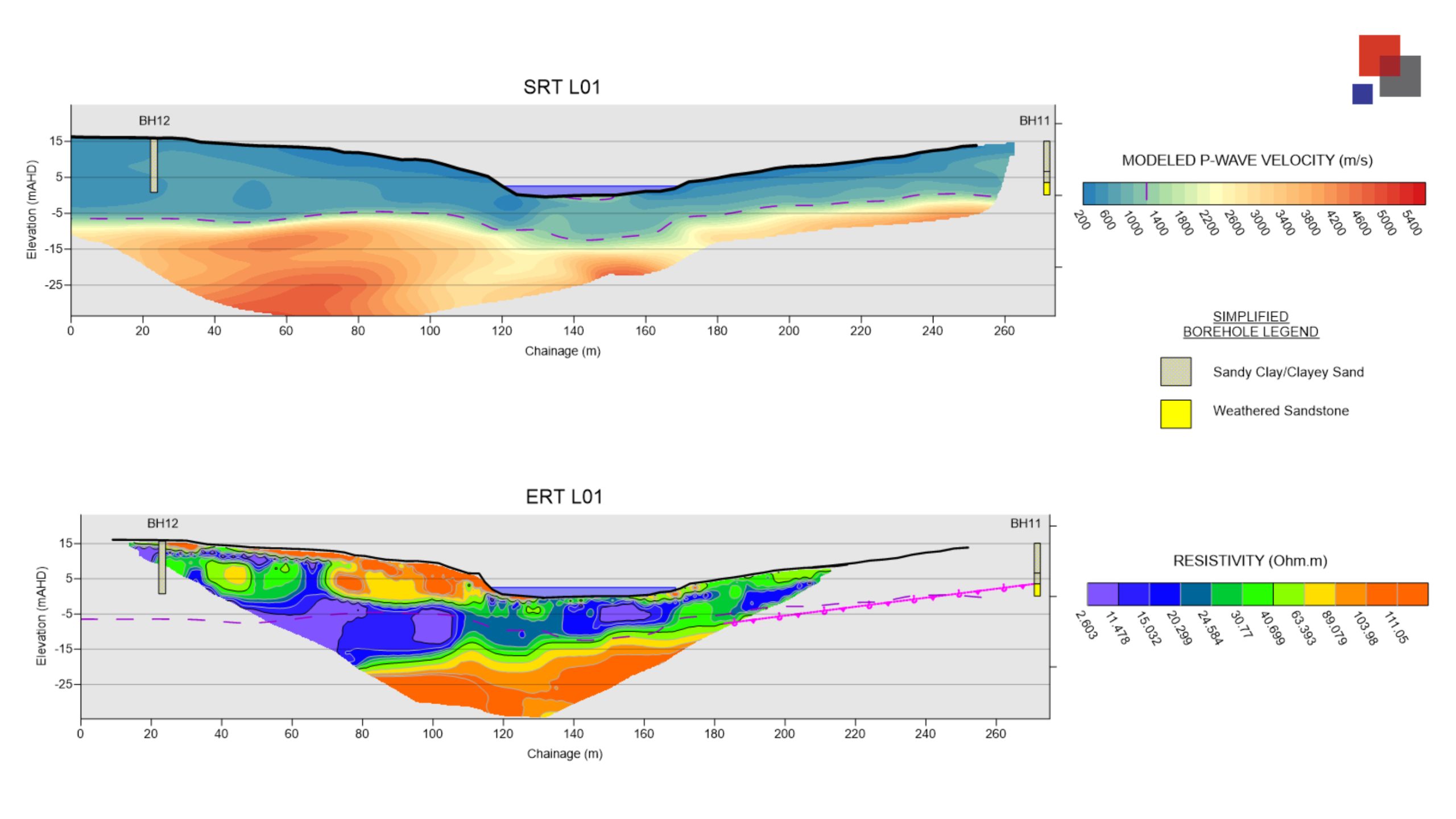
The SRT and ERT datasets supported each other and pointed to a consistent two-layer model. SRT gave a clear interpretation of the top of rock along the full transect. ERT added detail on how the ground changes from side to side, picking up variations that likely reflect differences in moisture, weathering, rock competence and clay content.
Borehole BH11 sat just beyond the western end of the transect. Even so, when the interpreted rock surface was projected to the borehole it lined up well with the top of rock logged there, which gives independent support for the interpretation.


