
Overview
Location
Regional South Australia
Year
2026
Sector
Methods
Electrical Resistivity Tomography
Frequency Domain Electromagnetics
Background
GBG was engaged to support a hydrogeological study of tailings infrastructure at a remote mining operation in regional South Australia. Seepage had previously been observed downstream of the decant dam, and several earlier investigations by others had already been completed. However, there was a need to review the available datasets, identify data gaps, and develop a more focused investigation that could improve confidence in the interpretation of subsurface conditions and potential seepage movement.
GBG Group first completed a desktop review of previous geophysical investigations. This included reprocessing and standardising datasets collected over multiple years. By applying a consistent spatial reference and colour scaling, meaningful trends could be identified across surveys that were not directly comparable in their original form.
This review informed the design of a refined Stage 2 investigation, targeting the shallow subsurface around the tailings storage facility (TSF) and decant dam. The objective was to deliver higher resolution data in the areas most relevant to hydrogeological interpretation
Objective
To provide continuous, non-intrusive subsurface information to support a broader hydrogeological model of the site, with particular focus on identifying seepage extent, potential preferential flow paths, and conductivity variations associated with tailings and decant infrastructure.
Methods
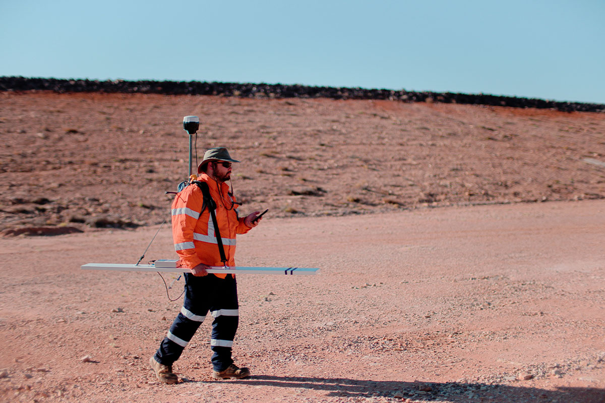
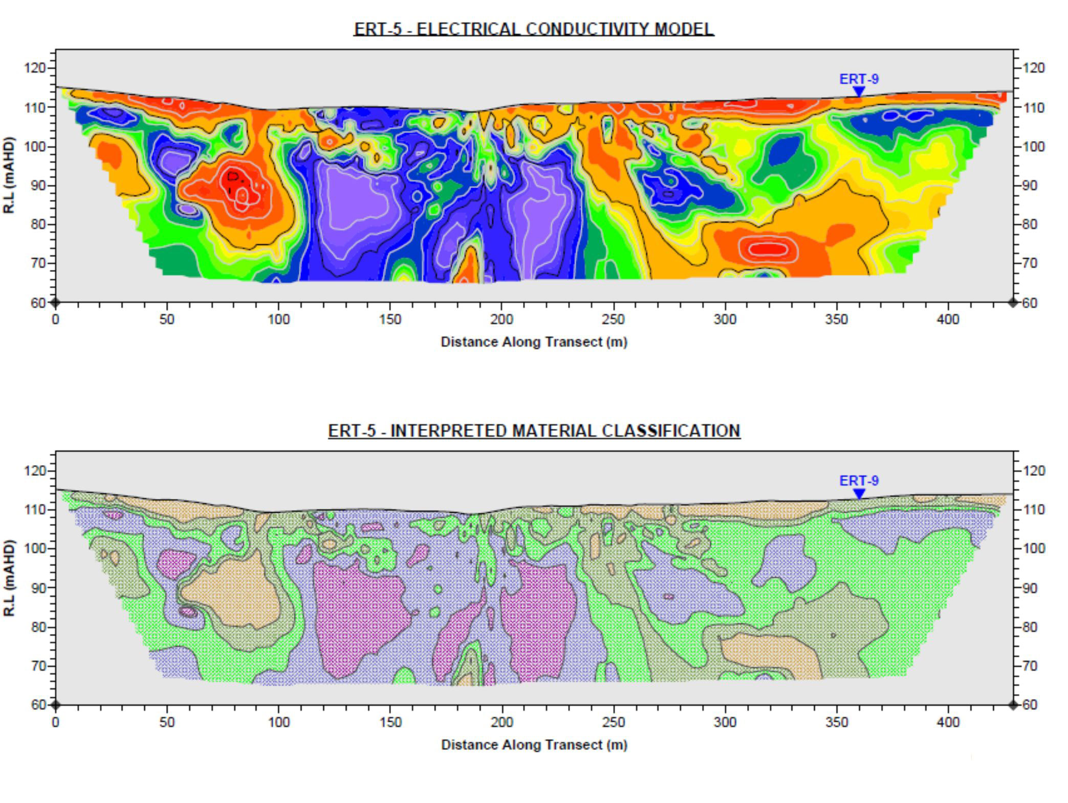
The investigation combined Electrical Resistivity Tomography (ERT) and Frequency Domain Electromagnetics (FEM). FEM was used to rapidly map near-surface conductivity variations across defined survey areas, while ERT was used along targeted transects to provide higher resolution cross-sectional imaging to depths of approximately 25 to 30 m below ground level.
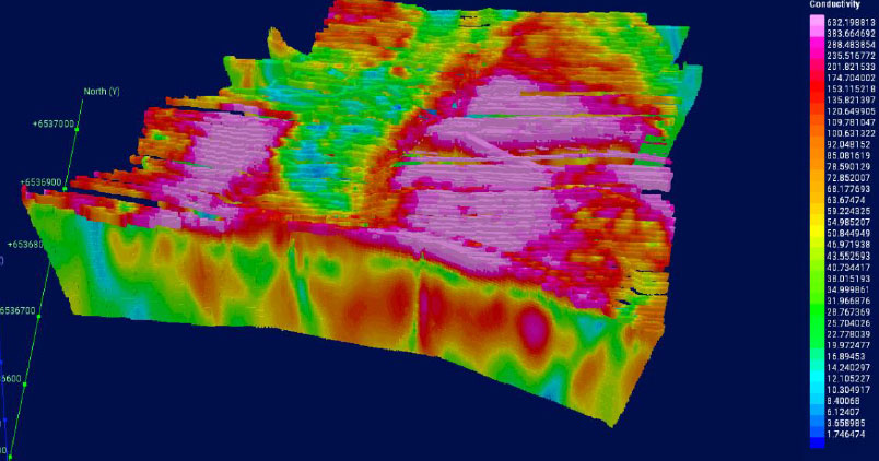
Fieldwork was completed in January 2026 by the GBG Group team and included approximately 1.2 km of ERT at the TSF site, approximately 3 km of ERT at the decant dam site, and FEM coverage over approximately 10 ha at the TSF and 18 ha at the decant dam. The processed ERT and FEM datasets were then compiled into a 3D Leapfrog Geo model to support integrated interpretation.

Outcome
The investigation significantly improved understanding of subsurface conductivity variations across both study areas.
FEM mapping identified laterally continuous conductive zones in the shallow subsurface, while ERT sections provided greater depth penetration and higher resolution imaging of conductivity structure. Correlation between the two methods was strong, particularly where shallow conductive features mapped by FEM aligned with elevated conductivity zones in the upper portions of the ERT sections.
The integrated interpretation helped define zones potentially associated with preferential seepage pathways and provided a clearer basis for hydrogeological assessment than earlier datasets alone.
By combining desktop review, targeted field acquisition, and 3D modelling, the investigation delivered a more robust framework for understanding seepage behaviour and supporting future monitoring and management decisions.


