Ground Penetrating Radar (GPR)

Geophysical methods provide subsurface insight with minimal ground disturbance, making them well suited to environmentally, archaeologically, and contamination-sensitive sites. They deliver high-density spatial data that improves confidence in ground conditions, reduces risk, and enhances safety by limiting the need for intrusive investigation.
Contact UsProudly Servicing Industry Leaders
Geophysical Insight for Environmental, Hydrogeological and Archaeological Projects
GBG Group Australia provides specialist geophysical support across environmental, groundwater, and archaeological projects, delivering non-invasive subsurface insight to inform decision-making, improve safety, and reduce risk. Our services support contaminated land assessment, groundwater investigations, and heritage studies by mapping subsurface conditions, identifying variability, and detecting anomalies associated with contamination, landfill, groundwater systems, and buried features of environmental and cultural significance.
Across environmental and groundwater investigations, geophysical methods are used to delineate landfill boundaries, map uncontrolled fill, identify unexploded ordnance (UXO), historic mine workings, buried infrastructure and tree root systems, delineate leachate migration pathways, and characterise aquifer systems controlling groundwater movement. These methods provide critical spatial context across a site, particularly where traditional intrusive investigations are limited by access, cost, or environmental sensitivity.
For archaeological and heritage applications, we deliver targeted geophysical surveys to support cultural heritage management and risk mitigation, including the detection of buried structures and unmarked burials. These surveys enable efficient investigation of sensitive sites with minimal disturbance, helping to guide targeted exposure where required.
Contact Us
Methods
We utilise the following geophysical methods:

Electrical Resistivity Tomography (ERT)
Frequency-Domain Electromagnetics (FDEM)
Time-Domain Electromagnetics (TDEM)

Magnetic gradiometer

Micro-gravity
Drone survey
Applications
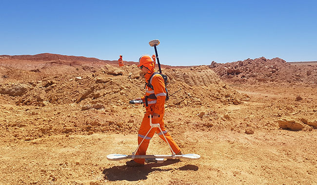
Contamination, Salinity and Acid Sulfate Soil Mapping
Mapping of contamination plumes, salinity variations, and potential acid sulfate soil conditions to support environmental assessments, coastal developments, and targeted ground investigation.
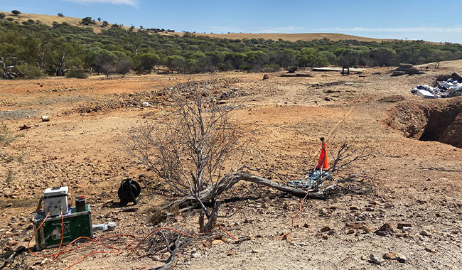
Landfill and Uncontrolled Fill Delineation
Mapping the extent and variability of landfill, uncontrolled fill, and buried waste materials to inform site development, remediation planning, and ground risk assessment.
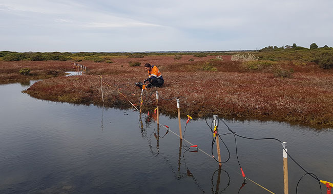
Groundwater and Aquifer Characterisation
Assessment of subsurface conditions controlling groundwater occurrence and movement, including aquifer geometry, weathered profiles, and saline or freshwater interfaces.
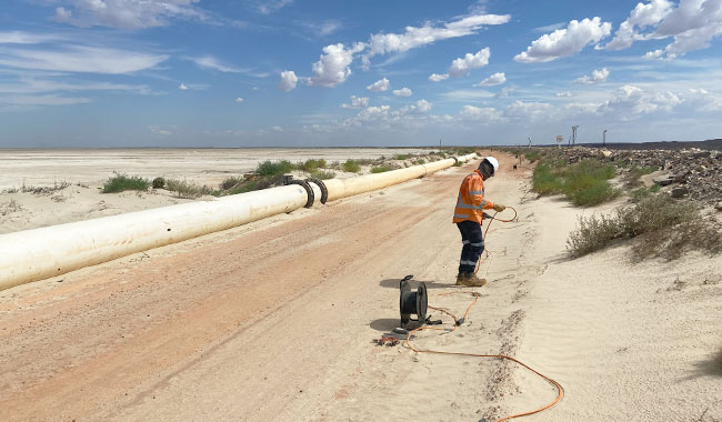
Seepage and Subsurface Flow Pathway Identification
Identification of seepage zones and preferential flow pathways associated with dams, tailings storage facilities, and containment structures to support environmental management and stability assessment.
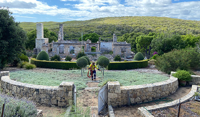
Buried Structure and Infrastructure Detection
Detection and mapping of buried structures, services, and legacy infrastructure, including foundations, tanks, and historic mine workings, to reduce risk during excavation and development.
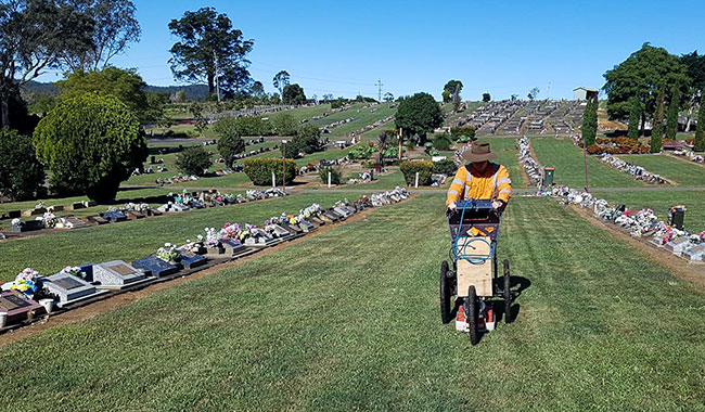
Unmarked Grave and Burial Detection
Detection of unmarked graves and human remains at cemetery or historic sites, supporting cultural heritage management, forensic investigations, and sensitive land use planning.
FAQs
Geophysical surveys are commonly used for contaminated land assessments, landfill and waste site investigations, groundwater and aquifer studies, and cultural heritage projects. They are particularly valuable where subsurface conditions need to be assessed over large areas or where intrusive investigations are constrained by access, cost, or environmental sensitivity.
Yes. Electrical and electromagnetic methods can identify subsurface variations associated with contamination, leachate, and salinity, while also providing insight into groundwater systems. These methods are typically used to screen sites and delineate areas of interest, which can then be targeted with intrusive investigation for confirmation.
The most suitable method depends on site conditions, target depth, and the specific investigation objectives. Factors such as ground conductivity, geology, access constraints, and required resolution and depth are considered when selecting an approach. In many cases, a combination of methods is used to provide complementary datasets and improve confidence in interpretation.
Geophysical methods provide indirect measurements of subsurface properties and are most effective when used alongside intrusive investigations. While drilling provides direct point data, geophysics offers continuous spatial coverage between those points. When integrated, the combined dataset provides a more reliable and complete understanding of subsurface conditions.
Typically, existing site information such as geological or specialist reports, existing intrusive test logs, site plans. Information on access, surface conditions, and any environmental or heritage constraints also assists in designing an efficient and safe survey.
Yes. Geophysical methods are well suited to contaminated, environmentally sensitive, and heritage sites as they are non-invasive and minimise ground disturbance. This reduces the risk of exposure or mobilisation of contaminants and allows investigation to be undertaken safely prior to targeted intrusive works.
No. Geophysics is typically used to complement, not replace, intrusive investigation. It is most effective as a front-end tool to screen large areas, identify variability, and target drilling or test pits more efficiently, reducing overall investigation cost and risk.
Geophysical methods are indirect and rely on contrasts in physical properties, meaning results can be influenced by ground conditions, cultural noise, and site constraints. Resolution generally decreases with depth, and some features may not be detectable where contrasts are low.
For this reason, interpretation by an experienced and qualified geophysicist is essential to ensure results are correctly understood in the context of site conditions and integrated with available geological or intrusive data.
Why GBG Group for Environmental Surveys
By integrating seamlessly with environmental consultants, hydrogeologists and heritage specialists, GBG provides clear, methodical outputs that support approvals, reduce uncertainty, and guide efficient, well-informed project decisions. We combine targeted geophysical methods with practical field experience and project-focused interpretation to support investigations across complex and sensitive sites.
Our capability in environmental geophysics enables identification of subsurface variability, supports contamination and seepage assessment, and assists in locating buried infrastructure and cavities – particularly where intrusive access is limited or carries risk. Contact us to find out more.
Environmental, Groundwater and Contamination Investigations
We provide geophysical support for environmental and groundwater investigations where non-invasive subsurface information is required to better understand site conditions prior to intrusive works. This includes groundwater studies, landfill investigations, contamination assessments, and seepage investigations where material variability or concealed features may influence risk and design.
Geophysical data can assist in identifying subsurface contrasts related to leachate migration, seepage pathways, buried waste, saturated zones, and changes in material type. These datasets provide spatial context across a site and help guide targeted intrusive investigation and improve confidence in environmental site models.
Archaeological and Heritage Surveys
Non-invasive geophysical surveys are widely used to support archaeological and heritage investigations where minimising ground disturbance is critical. Applications include the identification of buried structures, cultural features, unmarked graves, and other subsurface anomalies requiring further assessment by heritage specialists.
These surveys provide a practical means of investigating sensitive areas, supporting cultural heritage management, regulatory approvals, and the planning of targeted exposure where required.
Geophysical Methods for Environmental Projects
Method selection depends on project objectives, survey depth, expected ground conditions, target size and continuity, and site constraints. Environmental and heritage projects may utilise electrical resistivity tomography (ERT), electromagnetic methods, ground penetrating radar (GPR), magnetometer surveys, and micro-gravity techniques, applied individually or in combination.
Appropriate method selection and survey design are critical to achieving reliable results and are based on site-specific conditions and investigation requirements.
Latest Projects
View All

4,000+ Projects Across Australia and Asia-Pacific
Our experienced geophysical survey specialists work closely with engineers and project teams to design investigation strategies tailored to site conditions, risk profiles and engineering objectives. Speak directly with a geophysicist to discuss your project.
Contact Us
Please complete the form below and a member of our team will be in touch as soon as possible.
Our Partners
Partnering with industry leaders to strengthen technical capability and project delivery.